Silaj. Rhymes with collage. I’ve always had a dream of starting an outdoor brand. It typically didn’t go much further than that – just a thought in the back of my head. I had a few names in mind, did some logo design and that was the end of it. I always thought of it a personal brand for me – but not me. For people who have worked with me in the past, I’m not typically the person in the conference room who will blurt out solutions without first understanding the problem. I don’t really like to be in the spotlight – as I’ve gotten older and social media has ebbed and waned, I’ve been very comfortable with anonymity and doing my best work behind the scenes. This is more of a personality trait, but I don’t like to toot my own horn, I’d rather be the silent crusher behind the scenes. It’s where I’m more comfortable.
So the brand is almost like a proxy for my brand. Somewhat aspirational, but maybe does define how I think about the world. I’m still working through that I want it to be. But I’ve taken some steps.
It would be remiss to not call out the my assistant. Their name is Claude. And that’s exactly how I’ve used Claude to move this project forward. As a sounding board, as an assistant to execute things that I find onerous.
My workflow has changed quite a bit over the past few months. I’m using different tools, tracking multiple projects at once. I think as a creative, behind the scenes crusher, having an AI agent as an assistant has allowed me to move from idea to execution at a blistering pace. I’m sitting down to write this post because I’ve already dispatched my todo list for all projects and I need to reset for the next phase.
I find myself learning new ways of working and discovering best practices outside of my area of expertise. A couple of perhaps obvious learnings for me about how I’ve been working:
I don’t command an agent to do something, I ask the best way to solve a problem or achieve this goal. I explain what I’m trying to achieve. This has opened up new ways of thinking about a problem and gives me foundational expertise to move to the next step.
I always ask if the agent has any questions or clarifications before we start any work.
I take the results with a grain of salt and try to maintain some level of objectivity with the results – after all, it’s typically telling you what you want to hear.
For this first phase of Silaj, I started with basic brand and identity work, including brand guidelines and voice and tone guide. Then defined brand values (which is a reflection of my values). And finally to build some awareness and to introduce the brand, and landing page.
Not sure where it’s going to go. I have some ideas, but I’m pumping the brakes before I start to move in one direction or another. I need to think carefully about how to approach products, the brand, content marketing. At this point I’m just having fun and following my dream 🙂
We saw Stand by Me Live last week and it was just great to see the movie again and then hear the behind the scenes stories from the cast. I didn’t realize until the end that it was a Rob Reiner movie. I had forgotten. Highly recommend for a kick of nostalgia. This song has a quote from Chris Chambers (River Phoenix) in the junkyard scene.
Note: I also migrated by blog and lost all my subscribers, so… sorry about that… I enabled subscribed users in this WordPress instance, so if you like what you’re reading and want to follow along, consider subscribing.
I wrapped up work for the week and quickly threw my ski gear into the van. I had a rare window of opportunity to ski Friday night, van camp and drive home in the morning. In the flurry of throwing gear into a pile, I grabbed a pair of crampons, my avalanche beacon, probe, shovel, climbing skins and crampons and tossed them in the van just in case. When I’m skiing with the kids, they usually want to drive home and sleep in their own beds, so we end up arriving home close to 11pm and then I have to clean up and empty the van of wet ski gear – it makes for a late night . I would much rather drive the 10 minutes from the ski area to White River Sno Park, throw up the window covers, turn on the diesel heater, make some hot chocolate and watch a movie or read a book before going to sleep to the drone of the heater.
On the drive up to the mountain I started listening to Into the Ice: The Northwest Passage, the Polar Sun, and a 175-year-old Mystery. I bristle when friends tell me they’re “reading” a book only to find out they’re listening to an audiobook. I’m not trying to be pedantic – I’ve never understood it. Listening to the story, I had a difficult time with the chronology of events, when the reader changes from the present to some past historical fact. The words, for me, have a visual aspect to seeing the shape of the word, the paragraph breaks, the pull quote or aside. I’ve read that people who don’t read have a tough time spelling a word because they’ve never seen it, only heard it. That said, it’s difficult to read a book while driving. And I recognize listening is an efficient way to plow through a long book. The miles rolled by on my way to the mountain and I learned about the pros and cons of fiberglass versus aluminum hulls in sailing through pack ice.
The night skiing was good, not great. I’m working on skiing steep moguls more smoothly and the snow was in decent enough condition to ski laps on the upper bowls. There is a special time after about 7pm (the ski area is open under the lights until 9pm) when the crowds disperse, the wind picks up just enough to refresh the slopes and my legs are sufficiently warmed up to ski laps top to bottom and back up to repeat. It’s the flow state, rhythmic and singularly focused.
After skiing back to the van at the end of the night, I changed out of my ski clothes and was quickly underway. After a few short turns down the mountain, I pulled into the Sno Park and found a spot among the other camper vans. The lentil soup that I brought for dinner was still hot in the vacuum bottle. I slipped on my down booties, put my feet up and listened to my story. The book includes a fascinating history of Greenland and it’s political relationship with Denmark, which makes the recent US interest in Greenland all the more ridiculous. This is even more removed from the indigenous Inuit population and their history with European explorers (e.g. Great Britain claiming land rights for the empire in the 18th century). It’s a good story. Recommended.
I set the thermostat to 56 degrees (it was around 18 degrees outside) and climbed under my down blanket with my down boots and beanie still on my head. In the morning I peeked out the window and through heavy snow, and saw a line of cars pointing toward the ski area. These are the early risers hoping to get first chair and fresh tracks. I flipped the bed away and packed up the comforter and pulled out the stove to make breakfast.
1/2 cup of Bob’s Red Mill quick cook steel cut oats
2 teaspoons of chia seeds
1/2 cup of water
1/2 cup of milk
1/2 cup of walnuts
1/4 cup of dried cherries
1 tablespoon of maple syrup
Anything worth doing is worth doing slow, so get the water, milk and oats cooking. Put the chia seeds in your bowl and hydrate them with water or milk. Once they’ve expanded, drop in the walnuts and cherries. After the oats thicken (8-10 minutes) pour it in the bowl over the chia seeds and mix everything up. Finish it off with the maple syrup. Makes 1 serving.
The sliding windows were frozen shut, so I cooked on the Reactor with the back door cracked to keep the snow from blowing inside the van. When I’m solo, I find it overkill to set up the big two burner stove.
After breakfast I stowed everything for departure and went outside to brush snow off the windshield. The snow was falling steady in calm winds and in the distance I could just make out the trees leading up White River canyon. This is the moment when it clicked in my brain. I was ready to drive home (I had business to take care of in Portland), but I was here. And it was beautiful. And I had my touring gear in the van.
With half the windshield cleared of snow, I snapped a quick picture and jumped back in the van to quickly change into my touring bibs and shell. I put on the climbing skins, dumped my climbing backpack to see what was inside and started to repack. I turned on my avalanche beacon … and nothing. Were the batteries dead? I popped the case and … no batteries. I must have taken them out and not replaced them. So – no beacon. I adjusted the crampons to my boots and threw them in my pack. What am I even doing? I’m solo, there is about 8 inches of fresh snow. Where am I going? At that moment, I scaled back my ambitions and decided to ski to tree-line and then ski fresh powder back to the van. And avoid any terrain where I would even need crampons or a beacon. This was bonus time.
As I started up the road making first skin tracks, I waved a quick hello at a pair of skiers preparing to skin the same trail. After about 10 minutes they came up behind me and we chatted for a few minutes. They were going up to the Timberline Trail and then planning to turn right toward the ski area and climb up to the top of the Vista Lift, then descend. I know from my Timberline hike last summer that the Timberline trail out of White River is completely washed out – and steep. Might be a steep bootpack over downed trees I told them. They must have shuttled a car – I didn’t ask. They continued on (I was a little jealous of their longer adventure) and I followed their skin track to the point where they dropped in to cross the canyon at tree-line and then stopped to assess my position. Someone had built up a snow bank to block the wind coming down the canyon. It looked like a choice bivy spot on a clear night. I was at tree-line and it was a good time to turn around. I’ve gone a lot further up the canyon here, but it wouldn’t be a wise move to push on solo any higher. The canyon gets steeper and visibility would be tough with no trees.
I quickly ripped off the skins, switched my bindings, clicked in, and made fast tracks back to the van through light, deep snow. Less then 4 miles total, but enough to satisfy the itch. Happy to be alive and experience the snow and the cold and the wind blowing. I climbed into the back of the van and turned on the heater to warm up before changing and making the drive home.
Sometimes I think I should have been born in a different time. I would have readily volunteered for a polar expedition, or a circumambulation of a Himalayan peak, making due with what I’m carrying on my back, seeking out blank spots on the map. As I’ve gotten older I’ve grown to appreciate the small moments, to savor them. Life is just a string of moments.
What I like most about designing is creative problem solving.
My day job is designing systems that work together to solve some business problem. Typically involving a lot of data, financial systems and a lot of math. These days I’m designing software that allows banks and private credit funds to better manage their portfolio of loans.
Outside of software product design, I’m building things in my shop.
There is an aspect to design that just involves thinking. Up to a point.
Doing the thing is usually just executing the idea (as best you can). 80% thinking, 20% doing. There is also brute force design – when the thinking isn’t getting you anywhere, sometimes it’s best to just force the execution and let it fail. In failing, you’ll learn something new that will refine the idea. There is a parallel to life in general, to wax philosophical, sometimes you just have to jump.
This project took a lot of thinking, and a short time for execution. I put it off for a long time because I just didn’t have a solution.
The problem: When I drive up to the mountain in winter in my camper van, I want to be able to see the road when it’s blowing snow in the dark. There are times when I have the factory fog lamps on and I’m leaning over the steering wheel trying to make out any semblance of the road that’s covered in snow and ice. It’s sketchy.
Some constraints to solving this problem:
how am I going to mount the lights?
how am I going to control the lights after install?
how do I get power to the lights?
I decided that I wanted a simple mount for 2 fog lights, 2 LED lights at the hood, and 2 LED lights on the bumper to assist when backing up in the dark. I also didn’t want to install factory switches in the dash. They’re expensive, there isn’t a great way to indicate what the switches are used for (iconography), and they involve a lot of custom wiring. I did install a factory switch to control the Victron Orion DC / DC charger that’s powering the battery bank. It wasn’t necessary to install because the charger senses when it is receiving power from the alternator, but I wanted to further control when the charger was pulling power – if the battery bank is at capacity, I can switch charging off when I’m driving down the road. Very convenient.
First step was to install a floating light mount from Van Compass. It provides 2 light mounting tabs that extend through the front grill. I had to disassemble the grill for the install. The lights that I chose are from Harbor Freight, 6″ flood lights – comparable to lights from Baja Designs at 3x the cost with an amber cover. (Note: I also bought the wiring harness for the weatherproof plugs, but cut most of the factory harness off and rewired it). The mounting bolt for the light assembly was larger than the light mount tab, so I had to drill a larger hole and seal it with Rust-Oleum paint so the bare metal wouldn’t rust. Maybe the tab hole fits a Baja Designs light, but not the Harbor Freight lights.
I chose Sprinter ditch mount brackets from CBI Off Road for the hood and 4″ LED lights from Harbor Freight. For the rear bumper lights – 3″ Auxbeam LED lights. All quite straightforward up to this point. However, in deciding not to install factory switches on the dashboard, I needed another solution for powering and controlling the lights. In the past the standard solution was to install a series of relays for each light set and wire those to the vehicle battery. This creates a rats nest of wiring and fuses in the engine bay. A better solution is to install a switch panel that has built-in solid state relays, a fuse block and a separate control panel that can be mapped to the auxiliary system. The control panel is installed inside the vehicle, the switch panel is installed in the engine bay along with a larger 60amp breaker.
This is the part that took the most thinking and fabrication.
I used CAD (cardboard aided design) to design a mounting plate that would fit in the space above the ECU in the engine bay. The problem to solve was where to attach a free floating panel on which to mount the switch. There are 2 options in a VS30 Sprinter:
The bolts behind the windshield wiper arms. These are the metal bars that pivot to turn the wipers.
The hood mount bolts on the driver side.
I chose the hood mount bolt locations.
The angle of the panel needed to extend away from the side of the engine bay, yet be mounted in such a way that anything bolted to it would be supported.
My solution: I bought a piece of flat stock aluminum, 24″ long and 8″ wide. Using the cardboard template, I traced the shape that I needed on the aluminum panel including the angle of the bend. I don’t own a metal brake (yet) so I could have either riveted 2 pieces of aluminum together at the correct angle, or somehow bend the aluminum at the correct angle. Some types of aluminum are better for bending – this piece was 1/8″ thick and needed to be heated, or annealed, prior to bending.
Using the bandsaw, I cut the aluminum to the proper shape and while still flat (using the cardboard template) drilled holes on the drill press to match the spacing, angle, and size of the hood hinge bolts.
I drew on the aluminum with a sharpie and then heated it with a torch enabling the metal to soften enough to bend without breaking. A good test is when the sharpie begins to burn off from the torch, the metal is hot enough to bend. I used a bench vise and a 2 lb hammer to persuade the aluminum to bend at the correct angle.
I ran power from the battery (drivers seat floor) through the firewall to the breaker mounted to the panel, and installed the switch by drilling and bolting it to the aluminum panel. The panel isn’t fully supported and can vibrate when driving. All attachments use blue loctite so nothing can vibrate loose. The control panel is wired back through the firewall from the switch and mounted inside the cab where I can reach it while driving. I tapped into the dash USB-C power wire under the cup holders to install a 16g wire to tell the switch to wake up when the ignition is on.
It turned out better than expected. Looks good. Works well. I needed to adjust the hood alignment screw slightly as the hood moved a few millimeters when I removed the bolts to install the mount.
So how does it work?
I’ve used them coming back from Mt Hood Meadows this winter and with no cars approaching from the opposite direction – they turn dark into light.
It was day 4 of my Tour du Mont Blanc and I left Camping Grand Jorasses campground in Courmayeur at 6:30 and looped back to Rifugio Bertone on the main TMB route, and then climbed up Mont de la Saxe toward Col Sapin. This was the only section of trail that I backtracked, but I wanted to get up on the ridge to look across at the Mont Blanc massif. I had been leapfrogging a family (dad, 2 sons and daughter) most of the day and we had just begun the climb from Rifugio Elena up Grand Col Ferret. It was windy and I had my buff over my ears and windbreaker zipped up to trap in some warmth. This is the pass where the TMB crosses into Switzerland and is followed by a long descent to La Fouly where I would camp for the night.
My Wednesday evening British Airways flight leaving Portland was delayed by 2 hours and put my schedule of starting the Tour du Mont Blanc on Friday morning at risk. I was flying into Milan with my daughter where I would drop her off with her exchange family and then catch a bus to Chamonix. I checked the time when we landed in Milan and realized my window was closing. I still had to get my bag and go through customs, then get a ride to the bus station to catch the 23:30 bus that would get me to Chamonix by 4:00. I wasn’t going to make it.
Plan B was to spend the night at the host family’s house and then catch another bus Friday morning at 6:00 to arrive in Chamonix by 10:00. This would still give me enough time to procure a fuel canister, lighter and breakfast, and then take the short bus ride to Les Houches to start the TMB.
Les Houches to Les Contamines [9 miles, 2300′ vertical]
Day 1 began with a short lift ride up through the ski area in Les Houches. This wasn’t going to be a pure TMB as I was already planning to take the high route variations where possible and I had a reservation at Refuge Robert Blanc on day 2, which is not on the TMB. I didn’t feel the need to spend an extra hour walking up through the ski area to get to the trail proper.
The climb to Col de Tricot was pleasant with some peeks of Mt Blanc across the Bionnassay glacier. I was able to glimpse the Gouter hut sitting up on the ridge reflecting the sun off its silver siding. Gouter is the second hut on the Gouter route to the summit (after Tete Rousse), where most climbers sleep before summiting the next day. I really struggled with taking the week to climb some of the alpine routes around Mont Blanc, find partners through the Oak app, or hire a guide – or just solo the TMB in the 6 days that I had in Chamonix valley. I opted for the latter, but chose my route to keep me high on the mountain.
I paused often on the climb to drink my electrolyte mix and pick blueberries on the climb up to the col.
The descent to Refuge de Miage was my first introduction the steep descents on the Tour du Mont Blanc. Loose, rocky and very steep. The trail continued from Refuge de Miage, up over Mont Truc followed by another long decent down to Les Contamines.
I was making good time on a double track road and decided to eat something. Stupidly, I tipped my head back to toss some trail mix into my mouth and at the same time caught a toe on a rock. The speed and momentum I had going downhill pushed me forward and in a stutter step I caught myself, but then tripped again and my pack nudged me over the side of the trail. I threw my poles and tried to catch myself with my hands — there is a split second when you realize you’re going down. I landed on my side and with no poles, the right side of my face touched the ground. Not a slam, but enough to know I just landed on my face. I ended up sliding down the wooded bank on the side of the trail and stopped. I quickly retrieved my poles and climbed back up the the trail. The trail mix in my hand was gone – I didn’t find it. I stopped to look myself over to see if anything was broken, cut or bleeding. Just a knee scrape and some dirt on my face. Another hiker came down the trail a minute later, I told her what happened and asked her to take a look at my face to see if anything was awry. All good, but I was a shook. I vowed to never try to eat and jog again, and if I wanted to look at something or take a photo – stop. I was lucky because this stupid mistake could have ended the adventure.
I walked into Les Contamines, found the campground, took a cold shower, made my dinner and promptly feel asleep.
Les Contamines to Refuge Robert Blanc [9 miles, 6200′ vertical]
Col d’Enclave
I awoke to heavy rain and condensation dripping through my single wall tent. In the middle of the night I took out my pack liner and rain jacket and draped them over my sleeping bag to keep the drops off my down sleeping bag. I got dressed and packed up my kit while still inside my tent. I got as much water off the tent and then stuffed it loosely into the outside pocket of my pack and started toward Refuge de la Balme. It rained on and off during the hike past Notre Dame de la Gorge as I steadily climbed back up into the alpine.
Lord – give me the strength to smite this jetlag with the stoke. In our mother the mountain’s name I pray, Amen.
I arrived at the intersection of the main TMB trail to Col du Bonhomme and the alternate path to Lac Jovet. The ridges were enveloped in clouds, it was raining lightly and I sat down to consider my options. This was the optional high route that would slice off the main TMB route to Les Chapieux and reconnect to the TMB at Col de la Seigne – where I would cross into Italy.
Another hiker was stopped and looking at his phone, so I approached and asked if he was intending to cross Col d’Enclave toward Refuge Robert Blanc? Indeed he was, but was concerned about the weather up high. The pass is at 9000 feet and the conditions would surely be a factor. We made an agreement to team up and see how it goes – and to retreat if necessary. This is where I met Jozsef.
Col d’Enclave is a steep scramble that begins from Lac Jovet and gets steeper and steeper as you get closer to the col. It begins by climbing from the lake up a scree slope, then turns into a scramble following cairns up to the ridge. Halfway up the rain turned to snow and thick clouds were blowing over the ridgetop. I had all my rain gear on and my poles stashed. At this point we weren’t retreating. I checked Gaia and saw that we only had about 600 more feet to the top. We agreed to continue and take it carefully and slowly. Following a short celebration we dropped into the valley and stopped for a short break on the lee side of boulder.
We made good time traversing to the 2nd col we needed to cross, Col de la Grande Ecaille. This consisted of a steep decomposed shale slope and black mud. More slippery than anything. Once surmounted, we got our first glimpse of Refuge Robert Blanc across the valley.
As Jozsef said the next morning – we both went to our respective bunk rooms and went into “standby mode”. I was so chilled and depleted, I changed into warm, dry clothes and lay under the duvet on my bunk until my body temperature climbed. The conversation in the refuge was excellent – in French and English. Dinner was a multi-course meal of bread, soup with a slice of raclette followed by vegetarian chili and rice. And lastly a delicious cake for dessert. We agreed to hike together until we got to Col de Seigne in Italy, where Jozsef would continue to his refuge and I would push on to Courmayeur.
Refuge Robert Blanc to Courmayeur [12 miles, 3000′ vertical]
The next morning dawned with broken clouds and views of the snow capped 10k foot peaks south of the Mont Blanc massif. We were on the trail just after 7 and scrambled in the shade across the canyons carved by the retreating glacier. In my research I knew this section would be challenging – some sections of trail consisted of chains and steel steps anchored into the rock. It was enjoyable scrambling and we soon rounded a buttress into the sun where I stopped to apply sun cream and change into a sun hoody.
We were approaching a steep wall of a 500-600 feet and weren’t sure how we were going to ascend it – there didn’t seem to be an obvious path to the top. Col de la Seigne was at the crest and then we would begin the long walk down Val Veny toward Courmayeur.
As with most slopes, when you’re looking directly at them – they appear steeper than they really are. No doubt this wall was steep, but the path had steel cables anchored to the rock to use as hand rails as we switchbacked up to the top. A fall here would have been problematic – the steel handrails were a welcome safety measure. That was that: we were at the top in Italy and crossed the col minutes later.
The alternate path to Robert Blanc rejoined the main TMB route here and the number of backpackers and runners increased as we started down the roman road.
We stopped for lunch at Rifugio Combal where I laid my tent out in the sun to dry and ate my packed lunch from Robert Blanc. Jozsef continued on to his Rifugio and I climbed up the ridge on my way to Courmayeur.
Courmayeur to La Fouly [22 miles, 6400′ vertical]
The previous day was short in mileage, but steep in elevation. I knew that I’d have to begin laying down big miles to get through Switzerland and back into France. I chose a campground that was a bit closer to the trail (Camping Grand Jorasses) with the idea to return to town in the morning and grind out the climb up to Rifugio Bertone. Talking to some other Americans waiting for the shuttle bus to Courmeyeur I learned the bus continues all the way up the valley one way before returning to town – so I opted to start walking and connect to the TMB and backtrack to see Rifugio Bertone and climb Mont de la Saxe. In my research I read the views from the ridge across Val Veni were stunning and I wanted to take a look. I didn’t realize at the time that I would also be climbing Grand Col Ferret the same day – I just didn’t realize the elevation. This day turned out to be a sufferfest.
I rolled into La Fouly tired and hungry around 7pm. Most campgrounds have hot showers and a place to wash clothes. I took a well-earned hot shower, washed my clothes, made dinner and fell sound asleep.
La Fouly to Col de la Forclaz [20 miles, 5800′ vertical]
I took a 14oz nalgene bottle with me to use as a cold soak container and packed my normal breakfast of oatmeal, walnuts, dried cherries, chia seeds, raisins. I also mixed in 30grams of protein powder. I took 6 bags of this mix for breakfasts each morning. Adding some water and shaking it up to mix the protein powder, it turned into a dense gruel that got me going in the morning and offered some recovery protein. I think next time I’ll try to find something to add to the mix for more calories.
I packed up quickly and got on the trail to Champex Lac – this part of the TMB through Switzerland passes through some small villages – in my research I read about all the options for buying food along the way, but I think this is only relevant if you’re taking 10 days or longer and doing short days. A rise and grind schedule didn’t correlate with sitting down to eat restaurant meals. The morning consisted of a mix of roads and smooth trails downhill until the climb to Champex Lac begins. After a steep climb of maybe 1000 feet you enter the town and pass some boulangeries and cafes. I stopped and bought 2 large sandwiches, a coke and a piece of blueberry pie. I was climbing Fenetre d’Arpette today and needed the calories.
Fenetre d’Arpette is a pass on the high route of the TMB, an alternate to the main route. The climb started gently up a meandering creek and through fields of wildflowers, then traversed a scree slope before pointing straight up to the col where it becomes a scramble over large boulders following the red and white Swiss trail markers. I stashed my trekking poles on my pack and began to climb. The final few hundred feet consisted of a series of steep switchbacks over loose stones. The weather was good and I didn’t have the same concerns as crossing Col d’Enclave 2 days earlier. The views from the top were stunning of the retreating glacier across Plateau de Trient. If there is one theme of this trip – it’s the evidence of climate change and the retreating glaciers. Sadly, I was glad to see this part of the world before the glaciers are gone forever.
After a long descent to Chalet du Glacier, the trail flattened out and I made my way to a campground at Col de la Forclaz. There was also a hotel and restaurant and I could have gotten a room and hot meal – but I opted to stay true to my dirtbag roots and camp in the meadow with the other TMB hikers and runners. Good conversation, a hot shower and dinner and I was asleep in my tent for the night.
Col de la Forclaz to Chamonix [14 miles, 6400′ vertical]
It was always a toss up of where to stop for the night. I was self contained and could have camped anywhere within the rules of the country I was in – but continuing to the evening I always ended up at a campground. My pace was close to having 2 shifts. Morning until I could find extra calories or eat the food I brought. One day I ended up eating one of my oatmeal / protein mixes for lunch, the others I bought a piece of pie or a sandwich – then the second afternoon shift where I would power on until the light started to fade. It worked for me but I can see how the TMB could also be done more casually covering less miles between stops, or carrying lighter gear and covering more miles per day. My pack was about 6kg or 13lbs. I was able to run when my food supply got lower in the latter half of the trip.
I left Col de la Forclaz early and descended into Trient where I passed La Peuty refuge and campground. I could have covered these couple of miles the night before, but it was nice to start fresh with a short descent before beginning the big climb up Col de Balme. The weather moved in as I gained altitude and the views were limited. The wind was blowing quite hard at Refuge du col de Balme and I didn’t stop or go inside, but continued in order to drop some altitude and get to a more sheltered area on the other side.
Dropping out of the clouds, I got a first glimpse of Mont Blanc and the Chamonix valley after returning to France. I carried on – stopping frequently to take pictures and take in the views. After climbing back up to Col de Posettes I began to pass more day hikers who had taken the lifts from the valley up to the alpine to hike for the day. My least favorite part of the TMB was descending from Aiguilettes de Posettes – it was just a never ending technical descent of small cliffs and wooden steps – it went on and on and on and on. And on and on down into the valley.
Just after 1 o’ clock I walked into Tre le Champ and sat down at a trailside restaurant to eat a big lunch. I was running out of food – I had 3 gels left and a handful of Hi-chews and needed to make a decision about where to end for the day. Should I push all the way for Les Houches? Bivouac near Lac Blanc? Descend to Chamonix? I had a hotel reservation for the next night, but not tonight. I also had no food left. I left Tre le Champ with a belly full of raclette and blueberry pie and begin the climb up to the ladders above Argentiere. This was the last part of the TMB that I wanted to cover – this part of the trail is a series of steel ladders and cables bolted to the cliff. You ascend and traverse and scramble up to Tete aux Vents where you can continue higher to Lac Blanc or begin the descent to La Flegere and Chamonix.
I asked an Italian day hiker when the last lift descended for the day from La Flegere. He asked Siri who told me 5:30. It was 4:45 and I could see the top of La Flegere in the distance. The lack of food made it an easy decision. I set out for the lift and rode down to Chamonix where I booked a room for the night, took a shower and went out to get a burger and a beer (highly recommend The Roster in Chamonix for “The Cheesy”).
That was my TMB. It was a full week – 5 and a half days. If I hadn’t left the main TMB to Refuge Robert Blanc I probably could have finished in 4 days. I had a good conversation with a pair of French runners at Col de la Forclaz – they were fastpacking the route in the same number of days as me, though they were trying to get to Les Houches on the last day. Now that I’m familiar with the route – I’d like to go back and run it in 4-5 days. I’ll ask my daughter if she’ll join me 🙂
I met a lot of great people. I immensely enjoyed being solo and setting my schedule for the day. With a food resupply, I could have continued on — it’s possible to connect to the Haute Route from the TMB and finish in Zermatt, though I think I’ll leave that for a future spring ski tour.
I left myself one day in Chamonix to shop for gifts and to take the ride up the Aiguille du Midi. The views from the top were amazing and I got up close and personal to the exit from the midi to climb the Cosmiques Aretes and Mont Blanc du Tacul – among other routes.
Now that I know the mechanics of getting around and a have a mental map of the terrain – I’d like to go back and climb. Mont Blanc proper, and some of the other alpine routes in the valley.
Fin.
Note on the images: I took over 600 photos and tried to pare them down to some representative shots.
Mr. Consistency had some trouble being consistent in June. I had 2 work trips, got sick on the second one and missed my running weekly mileage goal. So annoying when “life” gets in the way of training. When I realized Friday the 4th was a holiday I checked in with the fam and asked if I could disappear for a couple of days in order to prep for my Chamonix trip in August. Shore leave granted so I packed my bags.
When my last work call ended on Thursday at 3, I threw my pack in the car and headed to Timberline Lodge for a smash and grab of the Timberline Trail. I started my watch at 5pm and took a right on the PCT Southbound. I kept the pedal to the metal until I got to Newton Creek and set up my tent to crash for the night.
Only one sketch moment crossing some steep snow chutes down into Clark Creek – which I think is part of Meadows / Heather Canyon? I’m not sure but I think this area is part of the Private Reserve. I had one more drainage to cross before looking for a campsite. The trail crossed a snow chute (I call it that because it ran for about 600 feet down to the bottom of the canyon). The crossing was about 15 feet to reach the other side of the trail. I paused and did a quick risk assessment – stop and put on the microspikes for added security or YOLO it and run/jump to the trail on the other side. I didn’t feel like taking my pack off to pull out the microspikes so I started to go and … the incident detection alarm on my watch started buzzing. I think because my heart rate may have spiked? That spooked me – and I realized discretion is the better part of valor and I thought it would be all over but the crying if I slipped and yeeted down the canyon into a rock. My body would be found with my microspikes in my pack. I backed it up, took of my pack and put on the microspikes and gingerly stepped across (not looking down of course).
I camped on the south side of Newton Creek and put off crossing it until the morning. There is massive erosion on the south side of the creek and the route across is not obvious. In the morning I ended up downclimbing holding on to tree roots while kicking boulders loose and finally squeezing between some large boulders to reach the creek.
There was another solo run/hiker/fastpacker that I was swapping places with all day on Friday. I saw him leaving Newton Creek, then passed him near Gnarl Ridge, then he passed me when I stopped to address a hotspot issue, he stayed ahead of me until crossing the Eliot, where I found him sitting in his UL chair on the side of the trail mixing up some electrolyte drink. He passed me again when I stopped to get water in Elk Cove and then I never saw him again.
I shuffled, ran, climbed, hiked from Newton Creek to Ramona Falls – taking the Timberline cutoff trail. The snow between Gnarl Ridge and the Cooper Spur Shelter made for slow going. I got to Ramona Falls at dusk, beat up and really hungry after 23 miles and nearly 5k of vert for the day. It was eerie seeing the evidence of so many people – trails everywhere, flattened open space, but no people. I was the only person there. It was like the Langoliers were about to come through – those monstrous creatures that devour the past. I filled up my water bladder, made dinner, popped in my ear plugs and promptly fell asleep.
I was up at 5:20 on Saturday, made breakfast, packed up and was on the trail just before 7. I missed the sharp U-turn to the PCT southbound and added an extra mile downhill toward the Top Spur trailhead. So glad I checked the GPS and realized my error.
I took the Paradise Park Loop and lingered in that special place for a little bit just enjoying the sunshine and views. I rolled into the Timberline Lodge parking lot at noon and stopped my watch.
By the numbers:
Thursday night (5pm – 7:30pm): 7.89 miles, 1,864 vertical.
It’s been a busy spring with winter hanging on with a mighty grip. Hood had fresh snow last weekend which should extend the skiing into June. My riding has been ticking up as a carry over from last year when I finally discovered all of the amazing cycling opportunities in the region. Some I can ride to from home, some accessed with a short drive in order to eliminate riding through busier streets. It’s been a lot of fun to get back on the bike for some long rides in the Gorge or west of Portland closer to the coast range.
I was deep in the Gorge last weekend near Larch Mountain on a solo mission following a course through some of the more remote parts of Bridal Veil creek. 5 miles up a logging road the trail abruptly ended at a tangle of downed trees, dense undergrowth and steep drainage on both sides. I was miles from nowhere going in circles, carrying my bike, jumping logs, walking in the creek bed with water up to my shins looking for a trail. I was wearing bib shorts, a synthetic t-shirt base, cycling jersey, summer arm warmers and an anorak shell to trap in the warmth. It was raining and my legs were getting scraped up from the briars.
It’s in these moments when you find out some truths about yourself. I ran through all possible scenarios. Continue forward into the unknown: maybe I’ll find the continuation of the trail. Turn around and ride back the way I came (the easy way out). I had 3 gels remaining – about 500 calories. I had a liter of water in my hydration vest, I was warm enough while moving. I didn’t have any way to make a fire, but probably couldn’t because of the rain. I was thinking about people who hike off into the rain forests in Hawaii never to be seen again. If I break a leg off trail, things could get serious. I had no cell signal – but saw that my phone could send an emergency message via satellite. I was studying GaiaGPS on my phone to see if I was anywhere near the trail (there was no trail in Gaia).
I kept going.
I continued to jump logs, passing my bike over, then climbing over and down. Kicking steps into deep moss to follow what looked like a steep logging grade. It wasn’t. I climbed back down, lowering my bike ahead of me. I continued walking through the creek and up the drainage and saw ahead of me a rise to a flat area. Relief. I was confident it was the continuation of the road. It wasn’t. Keep going. I was able to make out a narrow overgrown path of rocks and followed that – continuing to get further away from where I started.
I estimated I had 5 hours of daylight remaining — some cushion in case I needed to reverse course. I knew I could confidently follow my course backwards. After shuffling along and pushing my bike next to me I crested another small rise and saw a pile of boulders. This was the other terminus where the road continued. Spicy. I think if I was with others they would have protested and wanted to turn around. My grimmest thought was that if I perish here, I would just be absorbed into the forest. There are worse ways to go.
Another 2 miles up a forest road I overtook a hiker jogging on the road, I pulled up beside and said, “I just got really lost”. He asked where I started. Dabney Rec area, I told him. I still had miles left to ride to get back to the van. But I wasn’t lost anymore.
It’s volcano season in the PNW. Last Friday was the first time I’ve been up in a couple of years. I like that the sky looks black from the summit of Hood. I like the feeling when you’re near the top, pearly gates or old chute, and it gets tough, and you have to disassociate from the fear, it’s hard to describe… the only thought is the next move you’ll make – step up, reset a tool, weight it. The consequences are high, and it’s just you – your mind, your body, what you call “you” … or someone else inside you, moving you like a marionette. No – it’s just me 🙂 I can’t even really hear anything in that state. A strange relaxation comes over me – I like it a lot. I guess it’s one of the reasons why people climb… or participate in any high risk activity. It doesn’t get any more real. In modern times, it’s hard to find anything that quite compares. Mostly I like the suffering, I just do.
I don’t like descending (down climbing, facing in, looking down between your boots), but it’s part of the gig, so you just have to accept it and move deliberately. The steepest part is reversing into the old chute (we went up and down that way). Steep steps backwards down churned up ice, no good purchase until you descend a bit lower when you kick into the névé and you’re locked in.
I took 1 liter of water + a smaller 500mL soft flask. I ran out of water after I got back to the Hogsback. One of the guys I was climbing with gave me a swig which was enough for the ski back to Timberline. 2 liters + next time. I ate a smashed up PB&J, some clif blocks and a couple of gels.
Putting in a lot of vertical skiing this year (I just passed 20 days) has made me much more resilient in less than ideal ski conditions. I felt great skiing back from Devils Kitchen – just fun turns, no anxiety – which can happen with a pack on skiing out of bounds. The snow conditions below crater rock were patches of loose ice cubes and wind blown styrofoam. The snow closer to Illumination Rock had been in the sun longer, still had a thin veneer of ice on top, but was softened corn just below. It made for pleasant turns.
This was the first climb I’ve done with Mazamas (after joining 10 years ago). Highly recommended, would climb with them again. Chatting on the skin up to Palmer made the time fly.
I tried to collect the memorable climbs and adventures and ordered them in reverse chronological order. I know I’ve missed a few, but I’ll add them in the future.
Notable Trips (climbing and backpacking)
Year
Title
Route
Location
Partners
Success?
Notes
2025
Mt Hood
summit and ski descent
Government Camp, OR
Mazamas
Yes
Old Chute, ski from Devil’s Kitchen
2023
Mt St Helens
summit and ski descent
Cougar, WA
J+K
Yes
2021
Mt St Helens
summit and ski descent
Cougar, WA
T
Yes
2020
Mt St Helens
summit and ski descent
Cougar, WA
J
Yes
2018
Mt Adams
summit and ski descent via Piker’s Peak
Trout Lake, WA
Ax
Yes
2018
Mt Rainier
summit via Disappointment Cleaver
MRNP, WA
Ax & L
Yes
1 day plus (rested a few hours at Camp Muir)
2017
Mt Adams
summit and ski descent via SW Chutes
Trout Lake, WA
Ax
Yes
2017
Mt Hood
summit and ski descent from Hogsback
Government Camp, OR
Ax
Yes
2017
Mt Hood
summit and ski descent from Palmer
Government Camp, OR
T
Yes
2017
Wy’East Skimo Race
Ski Bowl
Oregon
Yes
Can’t remember the year.
2017
Mazamas Crevasse Rescue Class
Government Camp, OR
Oregon
Solo
Yes
2016
Mt Shasta
via Avalanche gulch, climb to Red Banks, ski descent
Mt Shasta, CA
M
No
2016
Mt Hood
South Side to Summit
Government Camp, OR
Solo
Yes
2016
Wy’East Skimo Race
Timberline
Oregon
Yes
Can’t remember the year.
2015
Mt St Helens
summit and ski descent
Cougar, WA
E
Yes
2015
Mt Hood
Summit and ski descent from Palmer
Government Camp, OR
M
Yes
2015
Mt St Helens
Standard Route, summit and ski descent
Cougar, WA
M
Yes
2014
Mt Lyell
Donahue Pass to summit
Yosemite National Park, CA
Solo
No
2011
Mt Baker
Heliotrope Ridge to summit
Mt Baker, WA
Ac
No
With Pro Guides from North Bend, WA
2009
Avy Level 1
Colorado Avalanche Info Center (CAIC)
Silverton, CO
Ac
Yes
2007
Eolus + North Eolus
Hike
Chicago Basin, Colorado
Ac
Yes
Northeast Ridge, Class 3
2007
Ouray Ice Festival
various ice routes
Ouray, Colorado
Ac
Yes
2005
Redcloud Peak
Hike
San Juans, Colorado
S
Yes
2002
NE Ice Festival
Lead ice course
North Conway, New Hampshire
Solo
Yes
1998
Presidential Range winter traverse
Lion’s Head Route
Pinkham Notch, New Hampshire
T
Yes
1997
Mt. Washington
Lion’s Head Route
Pinkham Notch, New Hampshire
T
Yes
1997
Chapel Pond Ice Climbing
Various Ice Routes
Adirondacks, New York
Yes
1996
Smuggler’s Notch
Various Ice Routes
Stowe, Vermont
D
Yes
1996
Mt. Marcy
Summit
Adirondacks, New York
Solo
Yes
on snowshoes
1996
Katahdin
Summit attempt
Baxter State Park, Maine
T
No
via Chapel Pond, Dudley Trail – (winter summit attempt) REI Grant
1994
Carter Range Backpacking
Carter Range Traverse
Pinkham Notch, New Hampshire
R & R
Yes
Notable Runs and Rides
Year
Route
Type
Location
Partners?
Notes
2024
Jack & Jill Half Marathon
Run
North Bend, WA
Solo
2nd place age group. Half PR of 1:37:01
2024
Various OMTM Gravel Rides
Gravel bike
Oregon
Solo
Did a bunch of the local long gravel rides. Hell of the North Plains, etc.
2018
Mt Hood Ride and Climb
Gravel bike
Oregon
Solo
Bicycle from Portland to Mt Hood, climb to Illumination rock, ski descent, bicycle back to Portland (unsuccessful Leuthold’s climb) w/Ax
The past month in the PNW has had pretty strange weather. We’ve had high pressure, sunshine, cold temperatures—and no precipitation. Two weekends ago, we skied at Meadows on chopped-up granular, aka packed powder, aka ice. It’s fine for carving but not super fun hitting refrozen moguls. N and I skipped behind one of the warming huts before the trail was closed and hit one of our favorite steeps. It consisted of frozen bumps, and we ended up cutting across the slope to get back to the groomers.
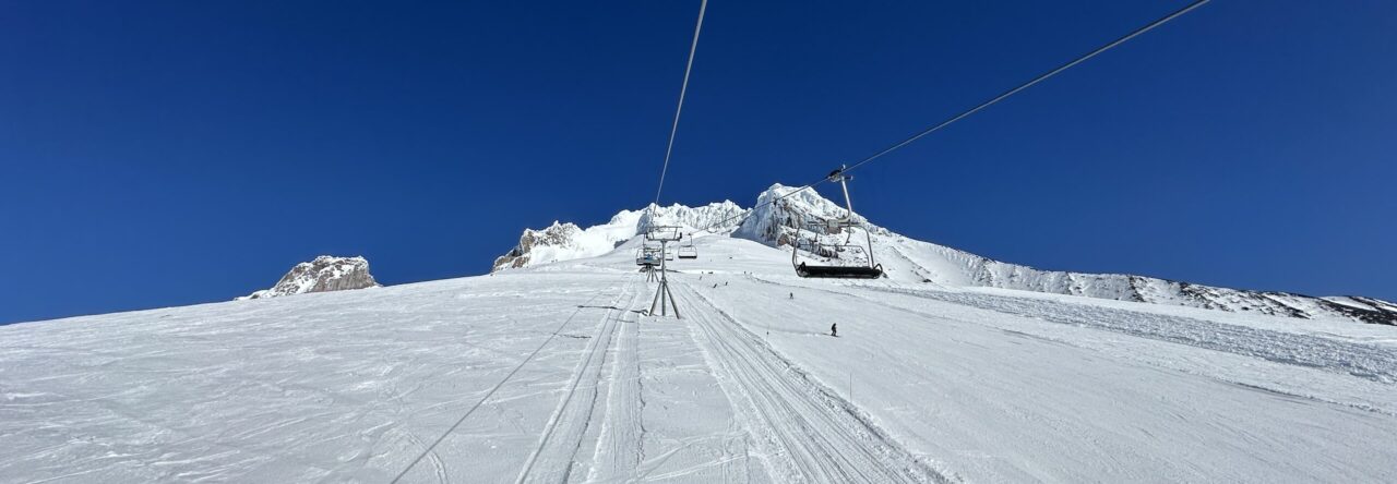
Last Sunday, with no snow in the forecast, I pulled the plug on Saturday skiing and instead took the van up to Mt. Hood to go climbing. I planned to skin up the south side and poke around—if conditions were good, climb up through the Pearly Gates to the summit. I left Portland around 4:30 and stopped in Sandy to pick up a burrito for dinner. The road up to Timberline was graveled and dry. When I pulled into the camping spots and turned the van off, I was rocked back and forth with red Mt. Hood kitty litter flying through the air—gusts to maybe 30 or 40 mph. Realizing the skin up Palmer was going to be a sheet of wind-scoured ice, I decided to reassess my plans and maybe settle for an overnight on the mountain.
After a hasty retreat back down the road, I took a left and decided to make for White River Sno-Park. There is usually a small crowd of people van-camping in the huge parking lot. I parked, put up my window shades, kicked on the heater, and ate my Chippy’s burrito. With the downgrade to a 2 a.m. wake-up, I decided to sleep in and have a leisurely climb up into White River Canyon. Just after sunrise, I was awakened by chatter outside the van. I peeped out my window to see maybe 30 people assembling with skimo gear in a few different groups. I started making breakfast and opened my door to ask the people right next to me, “Are you all together?” It turns out it was the Mazamas Backcountry Ski group doing avalanche training.
I got my kit together, put my skins on, walked up to the trail, and started up the east side of the drainage. I went around Pea Gravel Hill through the trees to the left and then continued up the ridge. At treeline, I chatted with another solo skier who had tent-camped near treeline. I think the low was 18°F. I had the heater in the van set at 66°F.
We talked for a few minutes about routes. He was going to try to ascend the ridge up and left to the Salmon River drainage and Timberline Lodge. It sounded neat, but it’s a steep slope consisting of wind crust and refrozen, old snow. I was reminded of a mistake I made once in Smuggler’s Notch, Vermont, when my climbing partner and I hiked up to check out the ice routes just as the sun was going down. Once the sun left the aspect we were on, it turned to a sheet of ice, and we had no way to descend. He slid back down with an ice axe and retrieved my crampons so I could walk down. Steep slopes of ice are sketchy. A lot of the time, what’s easy to ascend—either in crampons or kicking steps—can be a nightmare to descend.
I opted to drop into the river drainage and climb Boy Scout Ridge proper. I switched to crampons and a whippet, put my skis on my pack, dropped down, and then climbed up. I continued up toward the White River Glacier for maybe a mile. I decided to transition and ski back out when I took off my mittens to put a windbreaker on, and they started to blow away across the ice. I was getting blown around with my skis on my pack. Time to call it.
The ski out was uneventful except for negotiating the braided streams of the White River, crossing snow bridges, and hoping I didn’t take a swim in the water. Beautiful day for a solo mission—just enough to whet my appetite for spring corn skiing.
Snow is in the forecast for the weekend, so we should be back to our regular weather pattern (snow on the mountain and rain in Portland).
I didn’t leave room in my carry on for my journal. We only took small carry on suitcases and day packs so we didn’t need to check any luggage. I had my iPad, mostly to offload my camera SD card, and to watch some tv on the flight. It was a packed 10 days and I wish I had written down some notes while traveling around Spain and Mallorca.
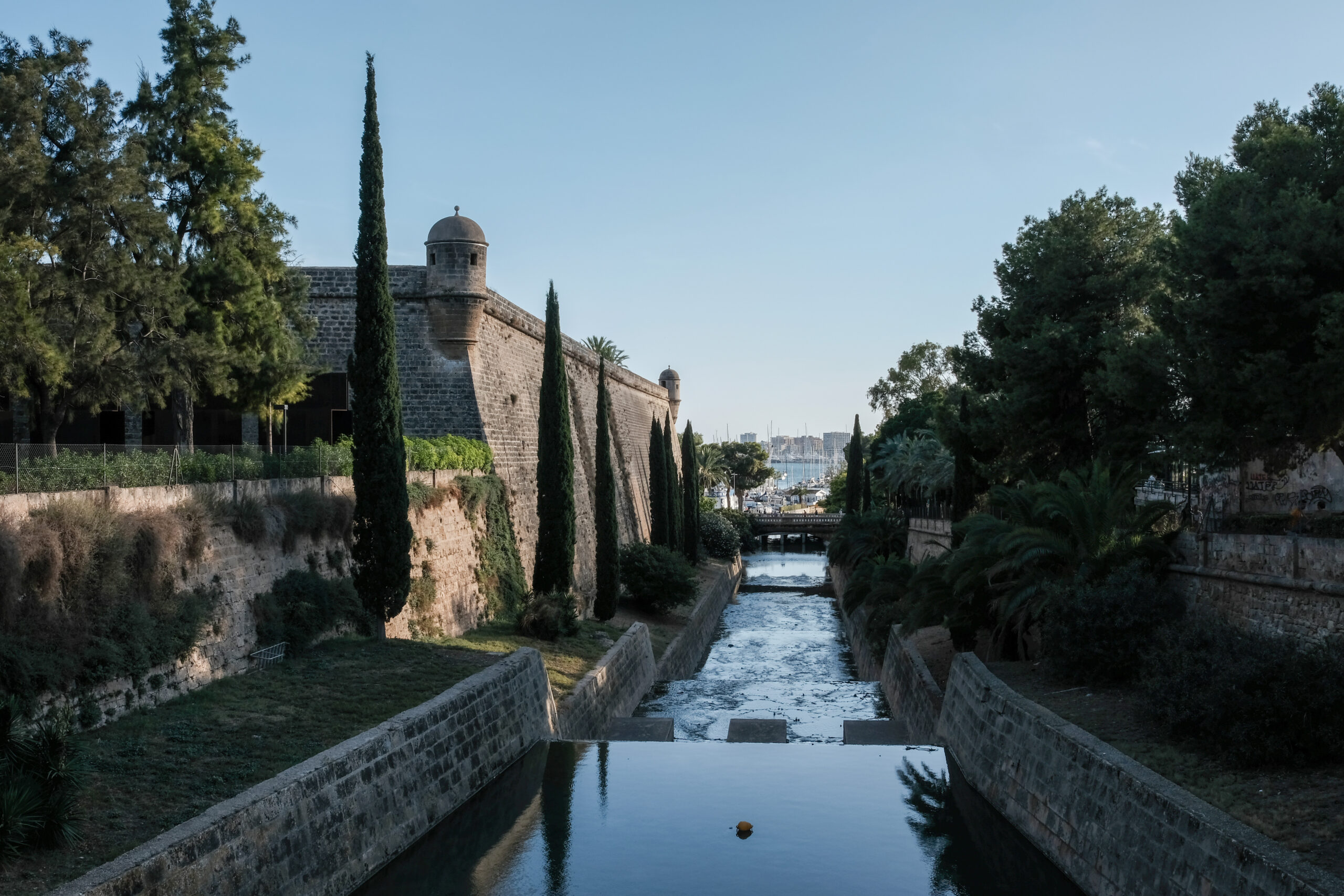
We flew from Portland to London then on to Barcelona where we stayed for a few days before flying to Palma, Mallorca. Then we reversed course from Palma and spent a night near the airport in Barcelona before catching a plane to London and then back to Portland. Uneventful plane time with the exception of some spicy turbulence flying into Barcelona.
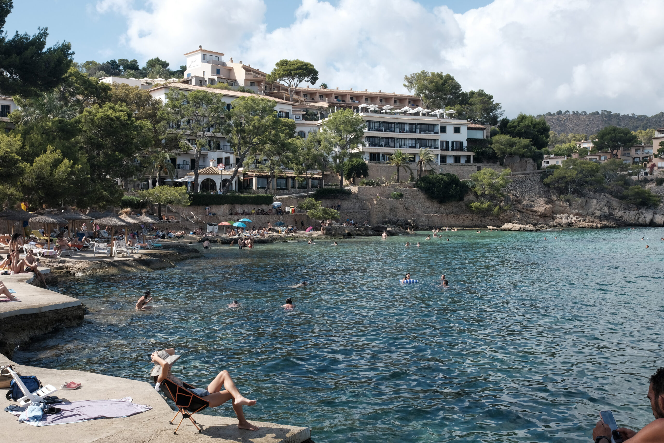
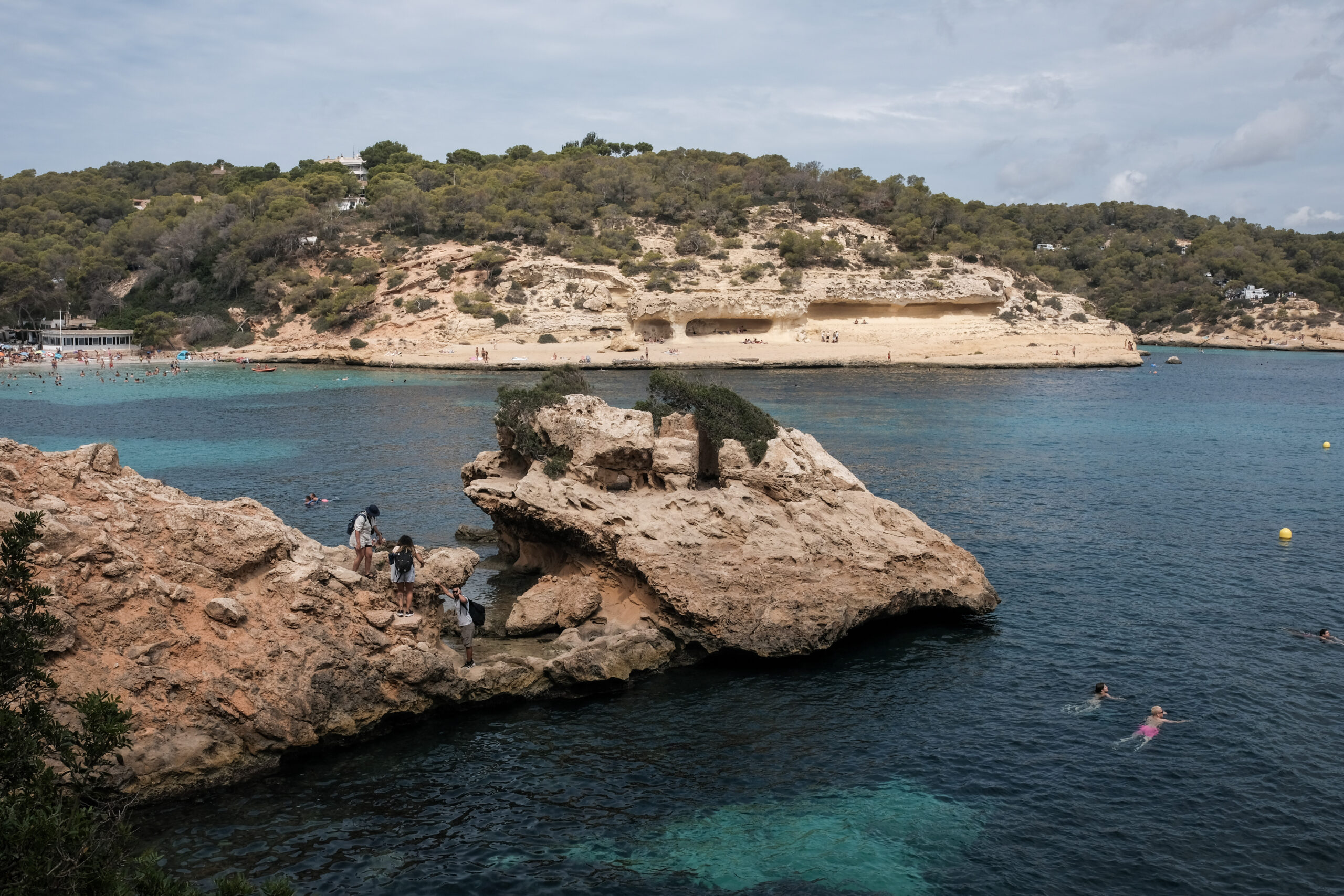
When I was wee lad, I lived in Berlin and traveled to Mallorca for vacation. It’s been a place I’ve wanted to return to for a long time. We hired a local guide to take us in his VW van to a few of the less visited beaches on the southwest side of the island. That was the vibe for us – driving to beaches through the Mallorcan countryside in a beat up VW van with a Belgian hippy…listening to Pumpin Blood from his Ibiza house playlist.
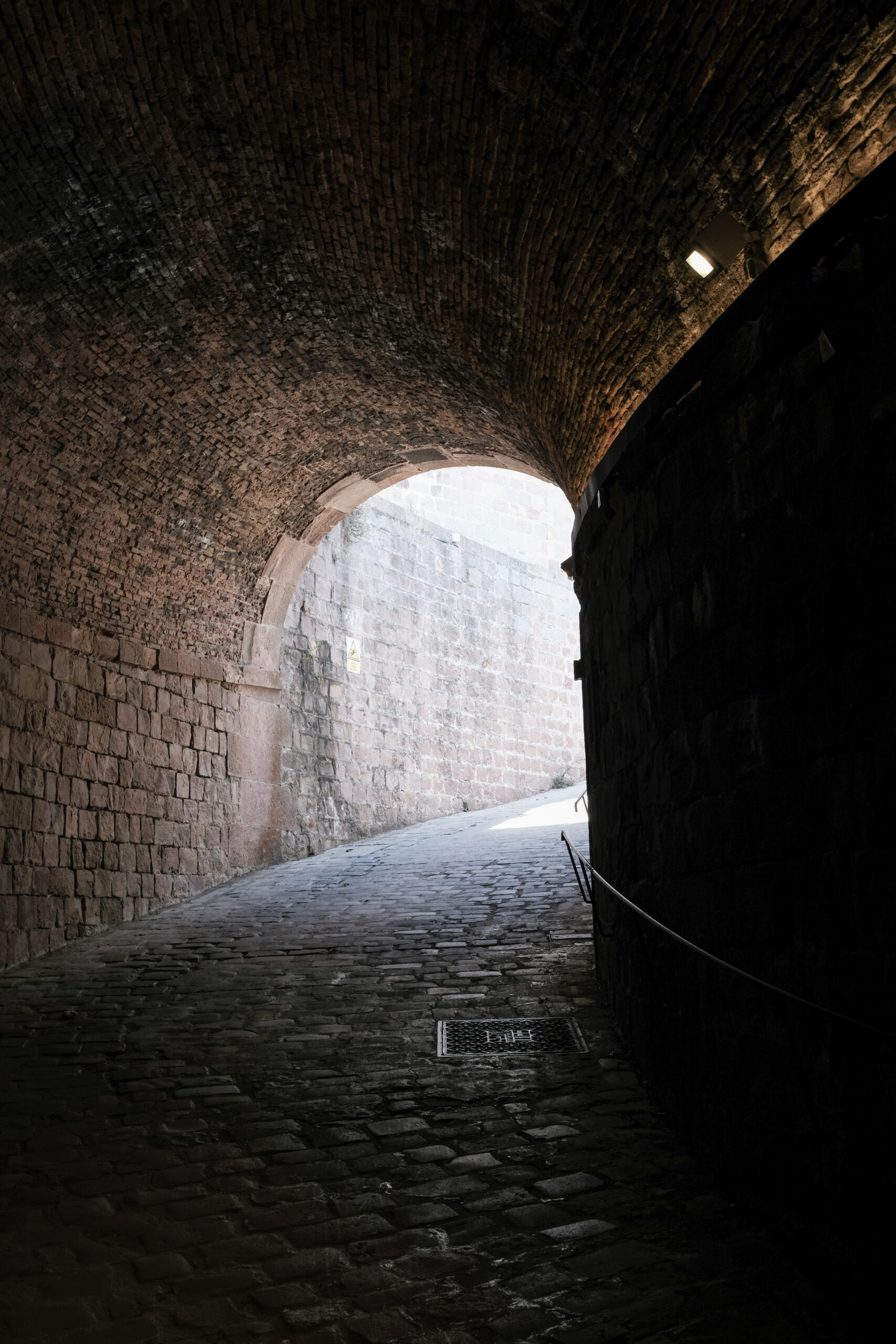
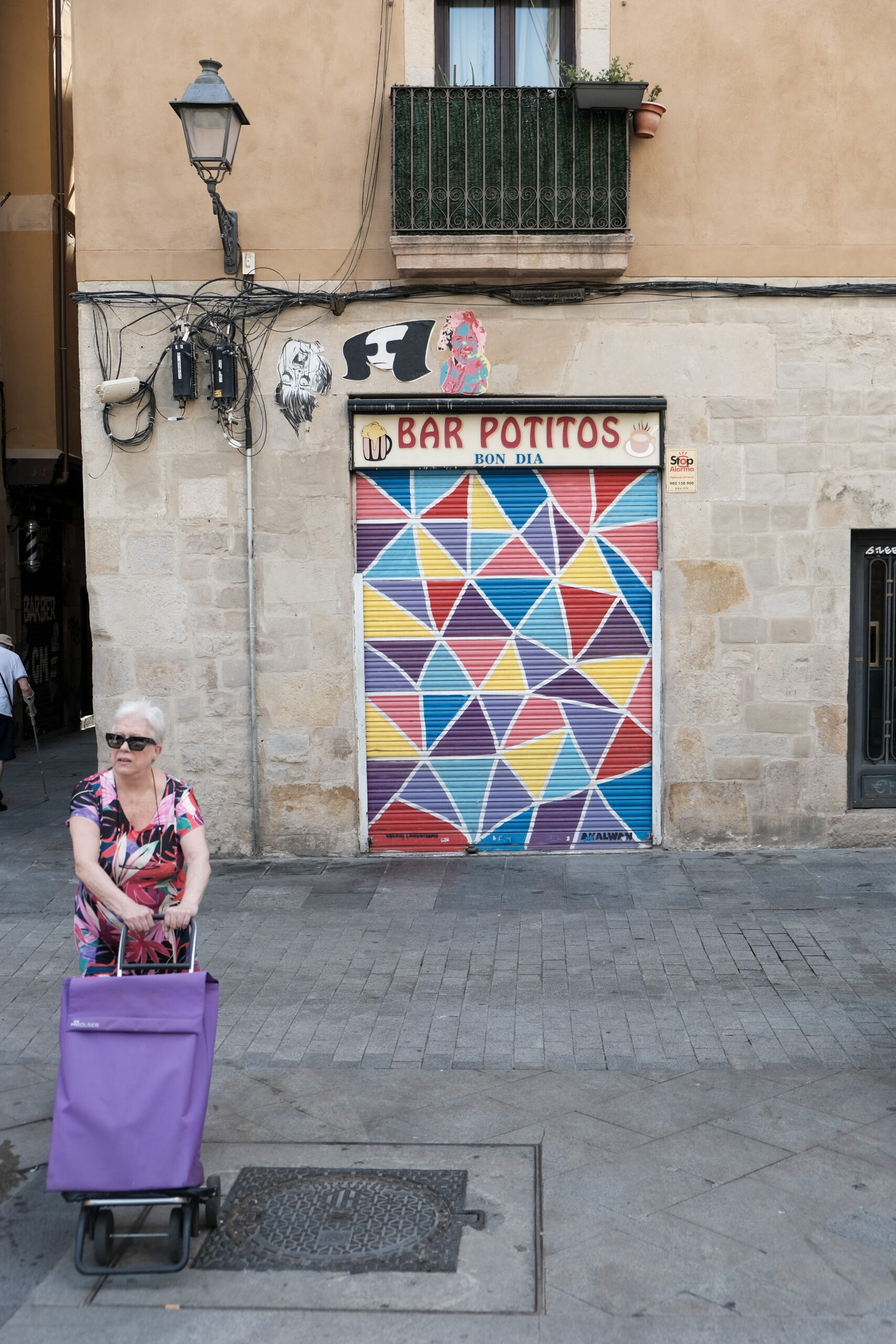
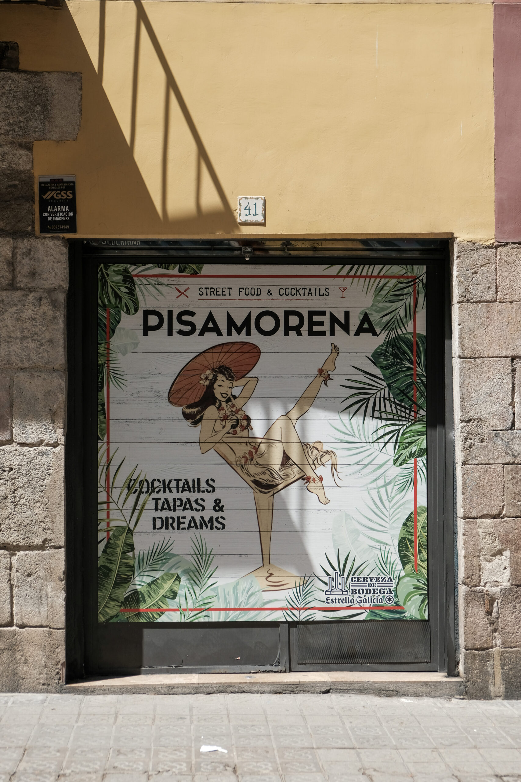
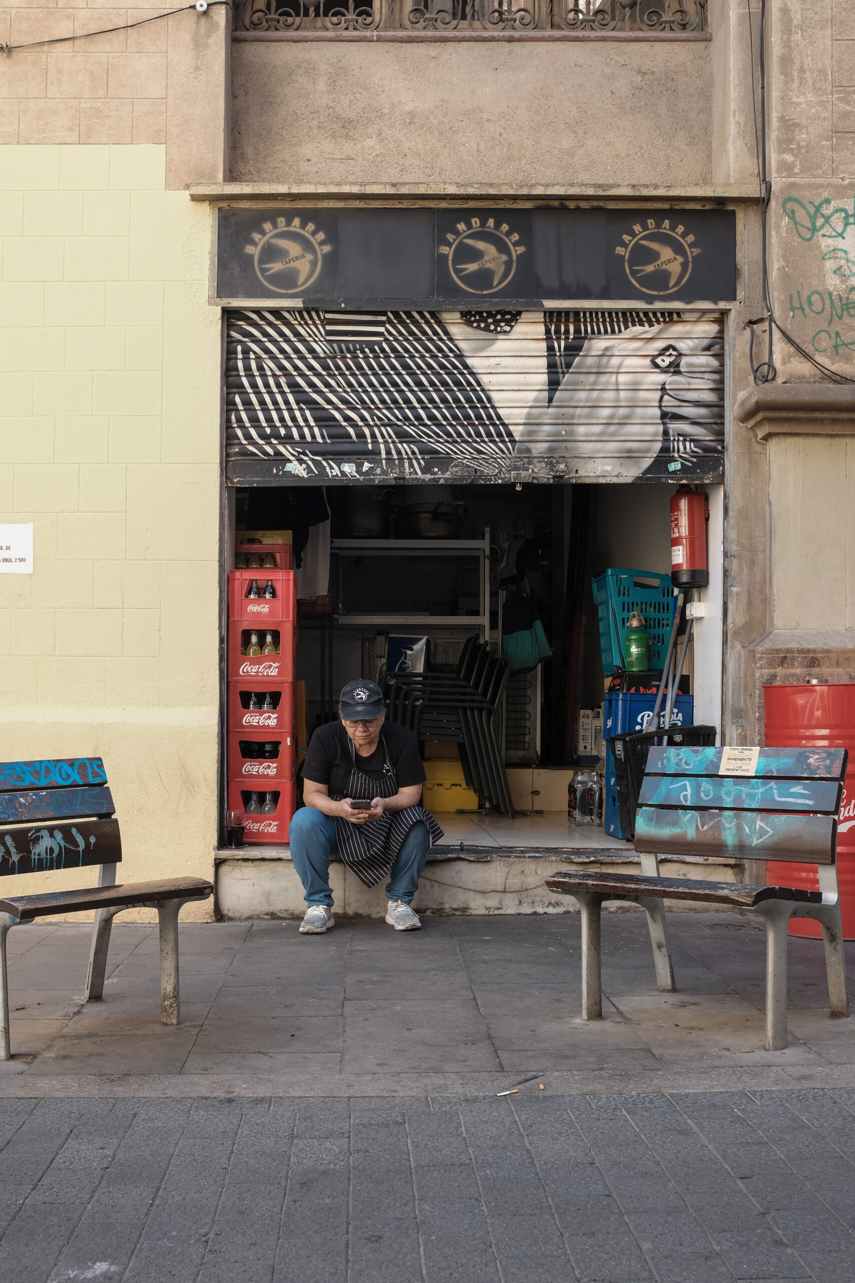
Barcelona… very cool city. We stayed in the Gothic Quarter near the border of the Born neighborhood. I liked the Born a lot – this is where the Picasso museum is located. The museum is comprised of many of his early pieces and shows his life in Barcelona. A lot of art galleries and little tapas restaurants and bars. Less crowded than the Gothic Quarter. Less touristy. More art.
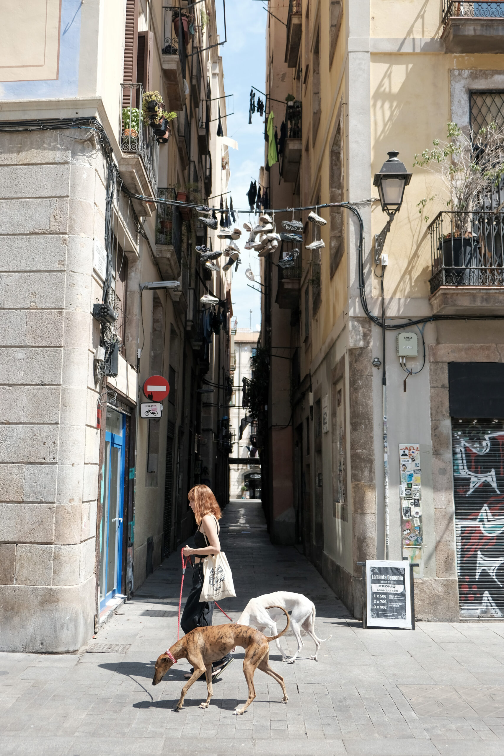
It felt like Barcelona was a large, functioning city. Public transportation was excellent (metro, taxis, bikes, scooters). Extremely walkable from Born to Barceloneta (where the city beaches are). My daughter and I ran most mornings – from the hotel in the Gothic to Barceloneta and back again. There are a bunch of people who get up early to exercise – around 7am is the collision of those who have been out all night, the early exercisers and the city cleaning crews cleaning up after the tourists. The food was good – some of it was a little too fried for my taste, but I had the most amazing tapas of grilled giant asparagus and parmesan with olive oil at one place. So good.
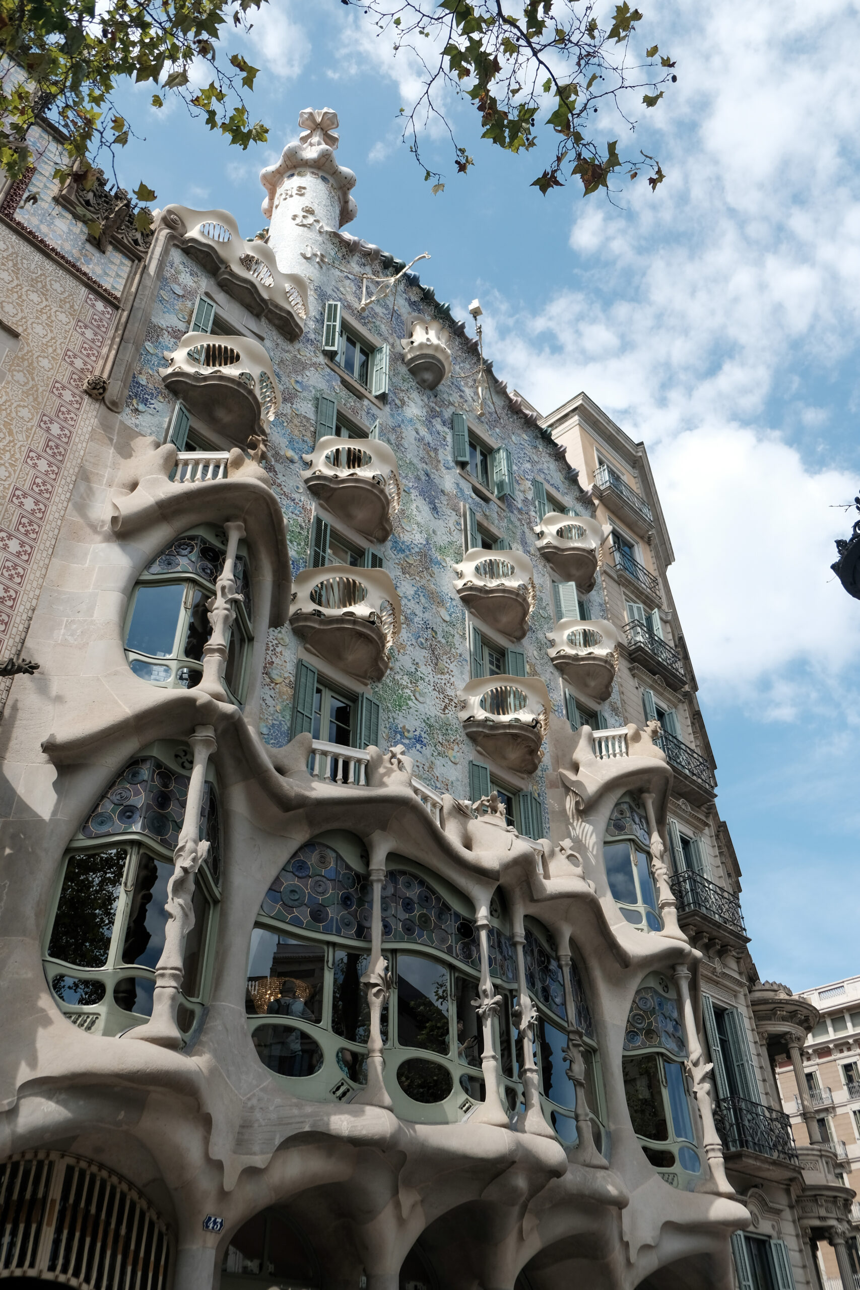
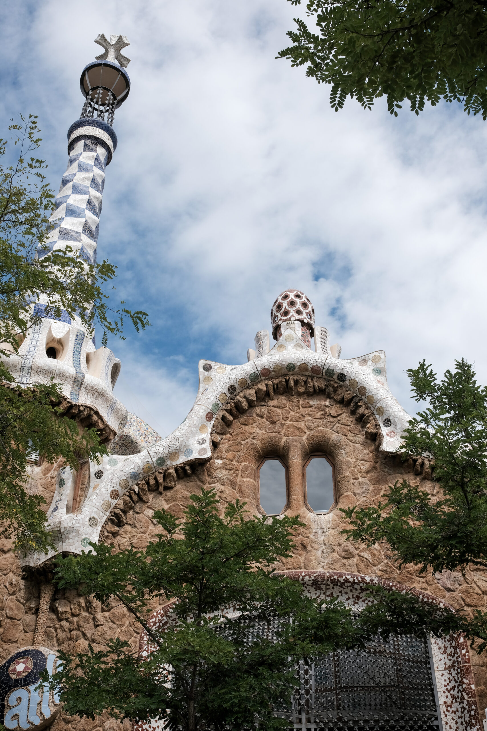
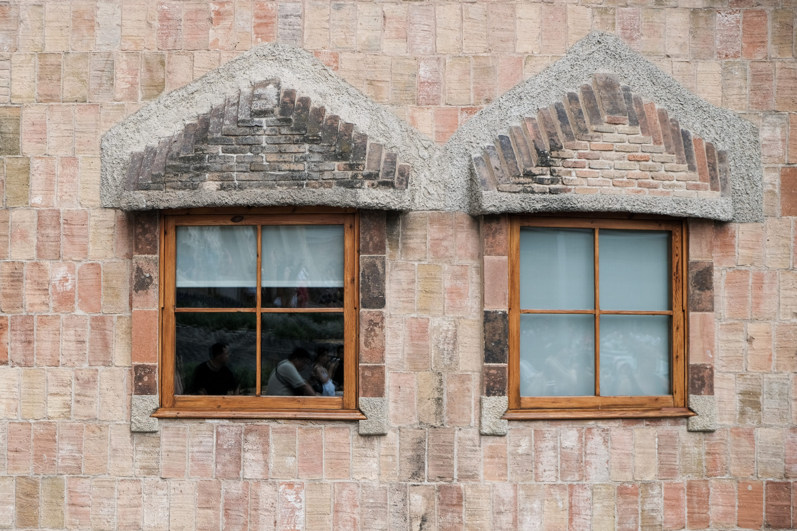
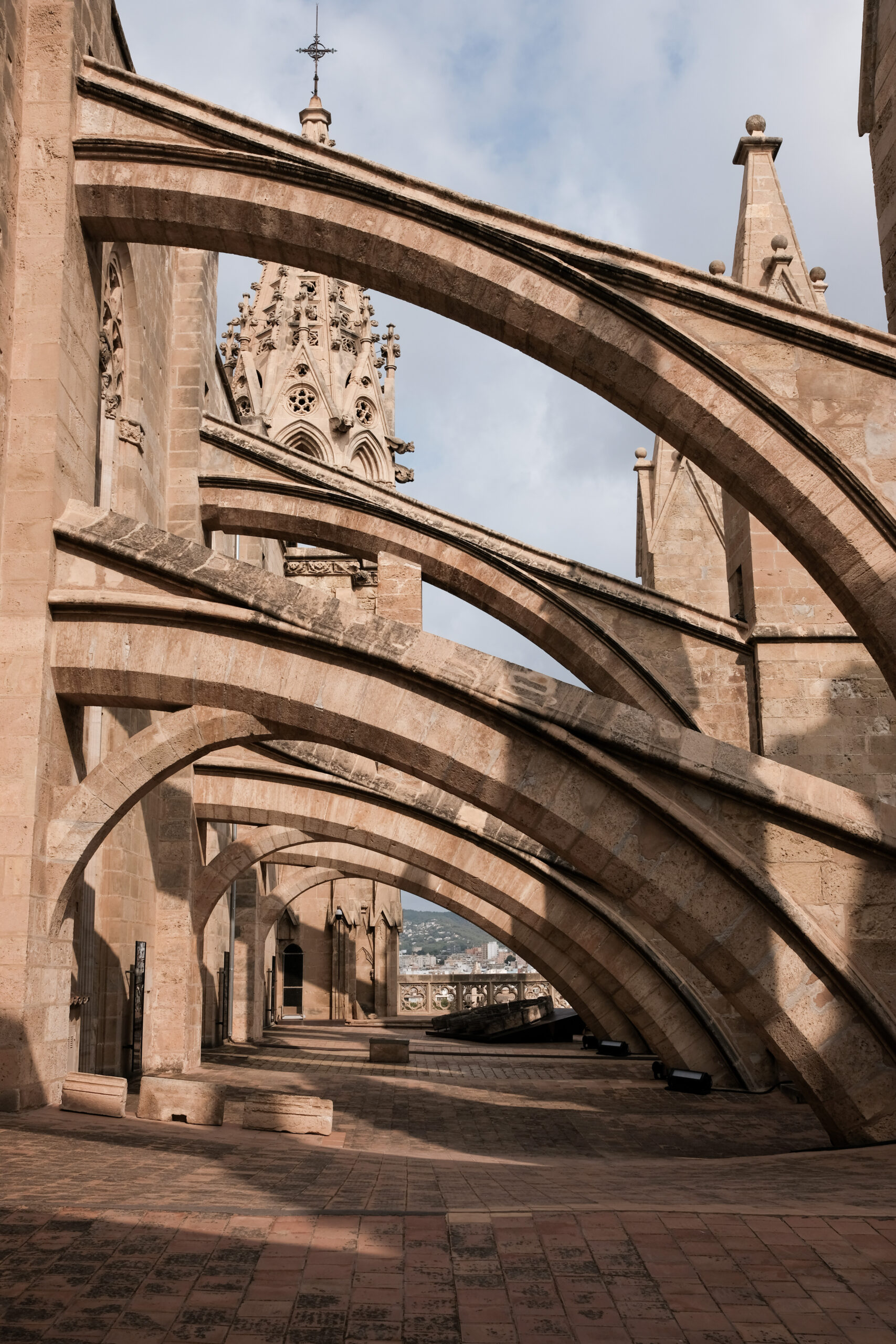
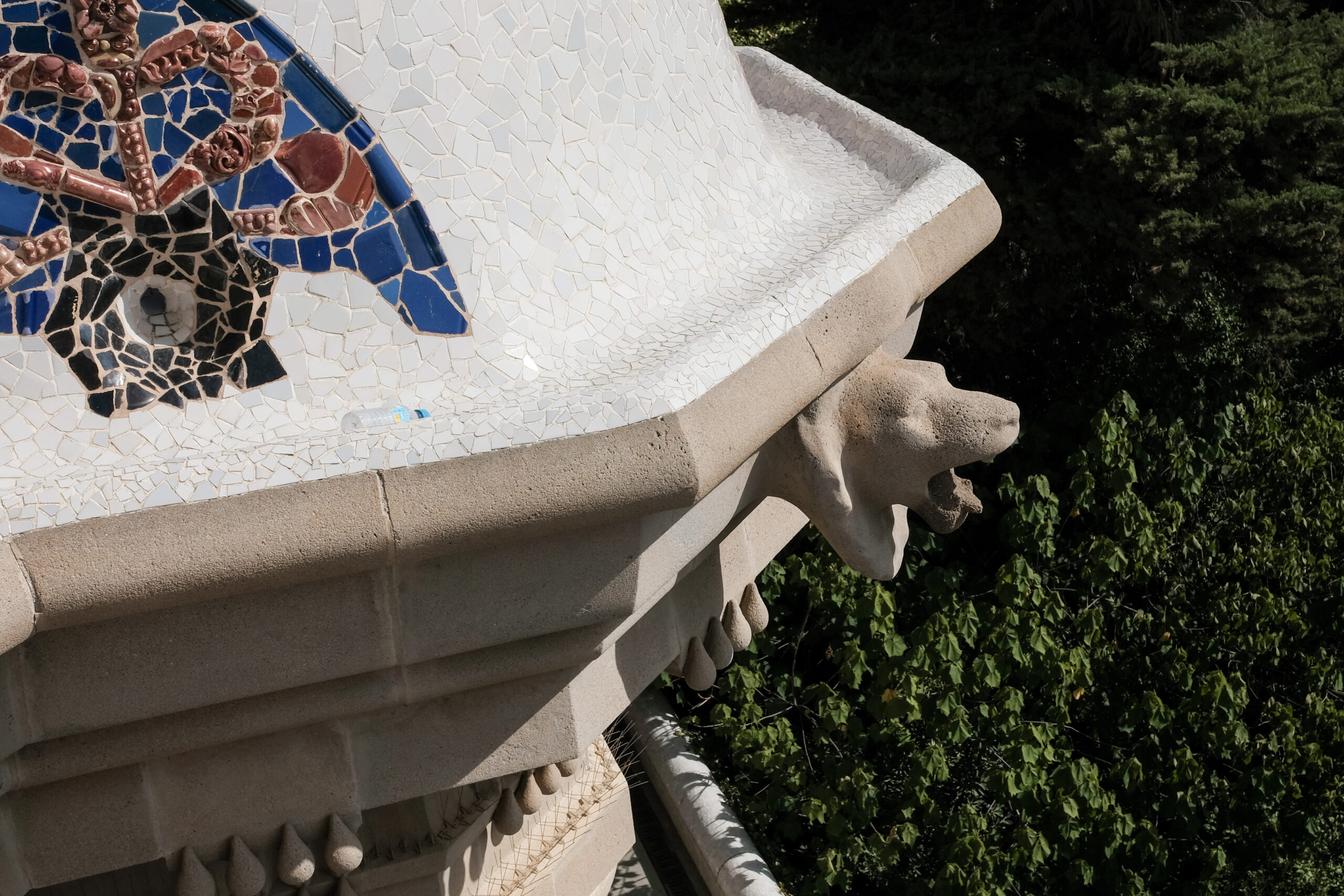
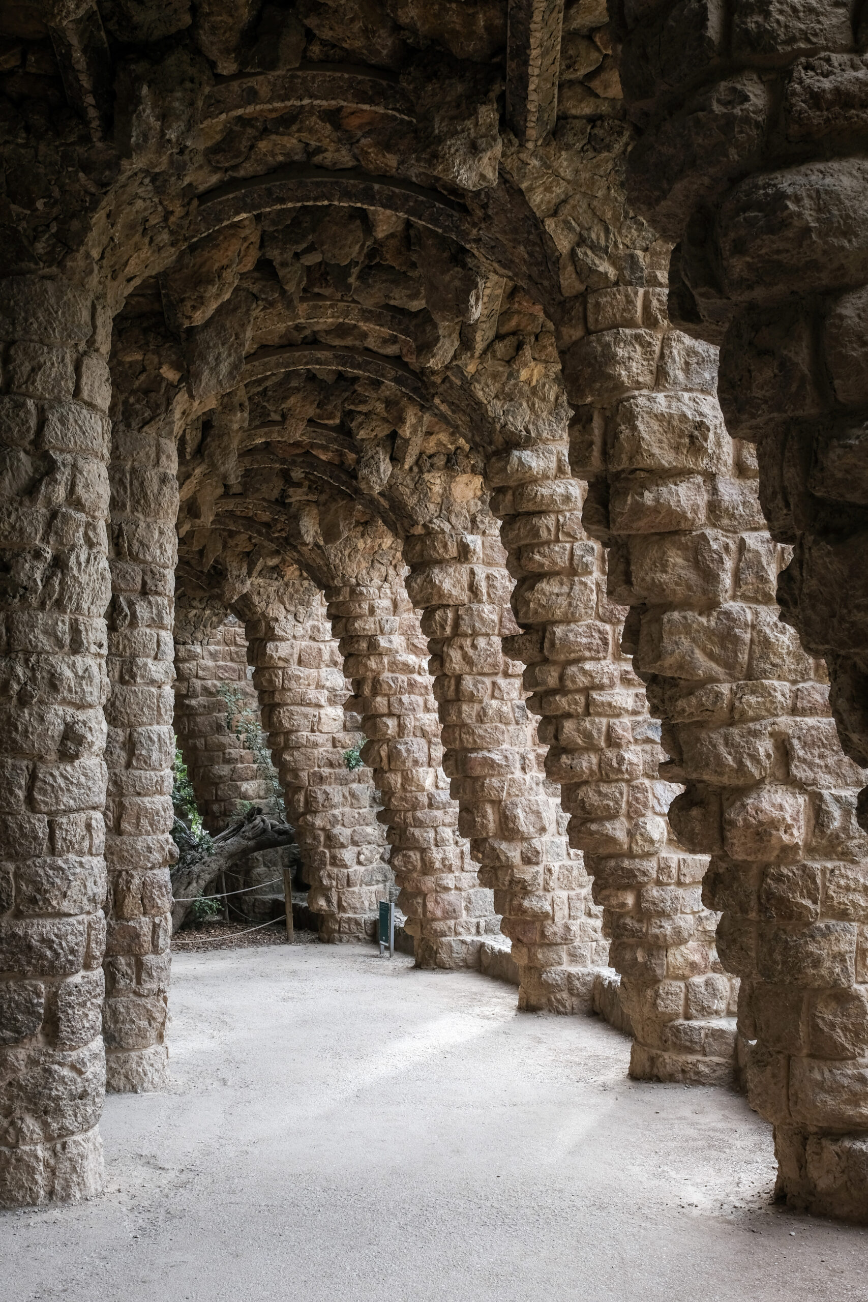
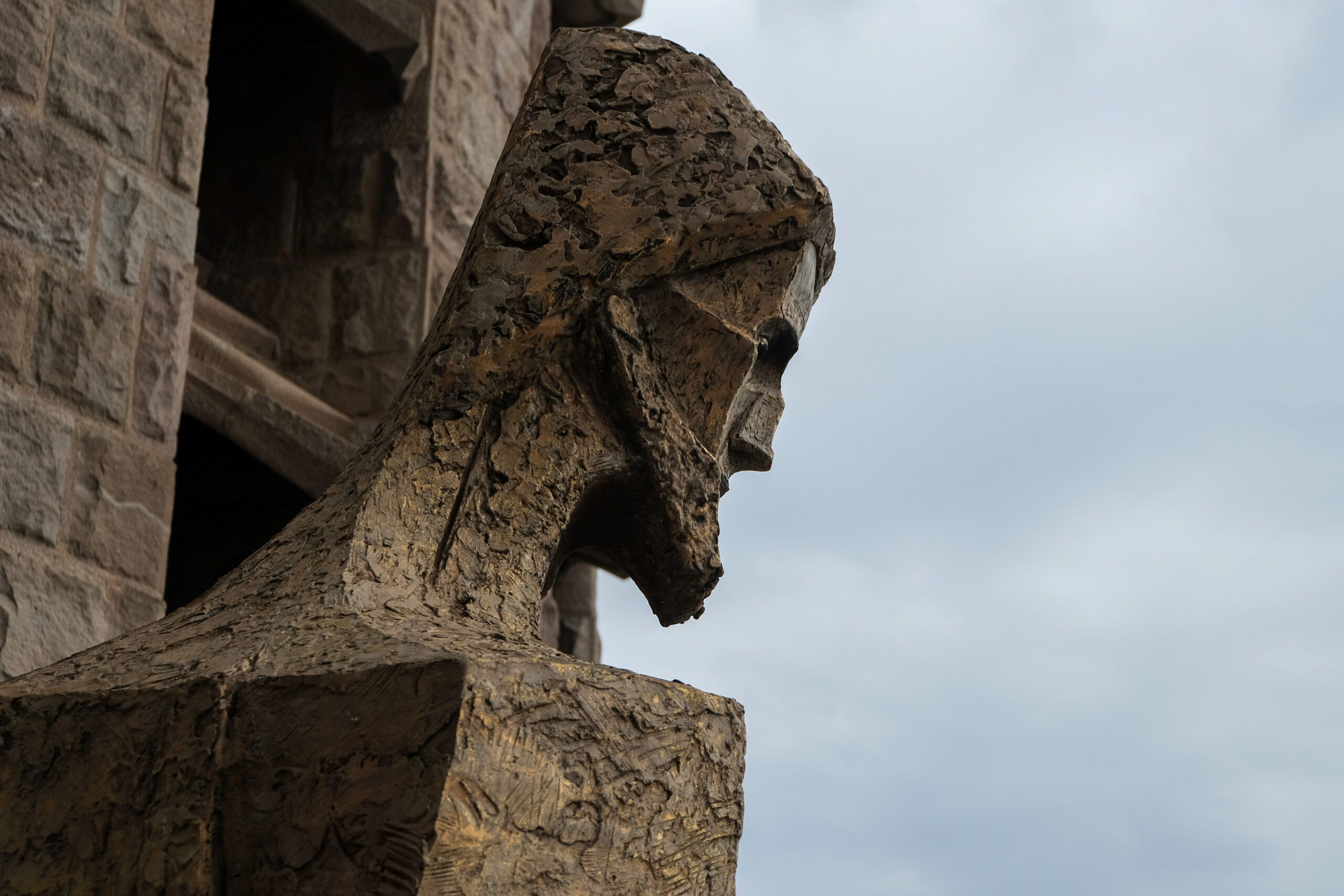
La Sagrada Familia looks like it was built by aliens. It’s difficult to describe. Beautiful stained glass. I took my 18-55mm lens and zoomed too much, I realized later I should have shot with the 23mm to capture more subjects in the frame to show scale. I used the 23mm the rest of the trip. Parc Güel was a very nice morning – we went early while it was still a little bit cool. Casa Batlló was beautiful – I was impressed with Gaudi’s use of organic forms and imagery from the sea was amazing. There’s a reason why people visit his works. Some of the rooms reminded me of the Victor Horta house in Brussels (Art Noveau).
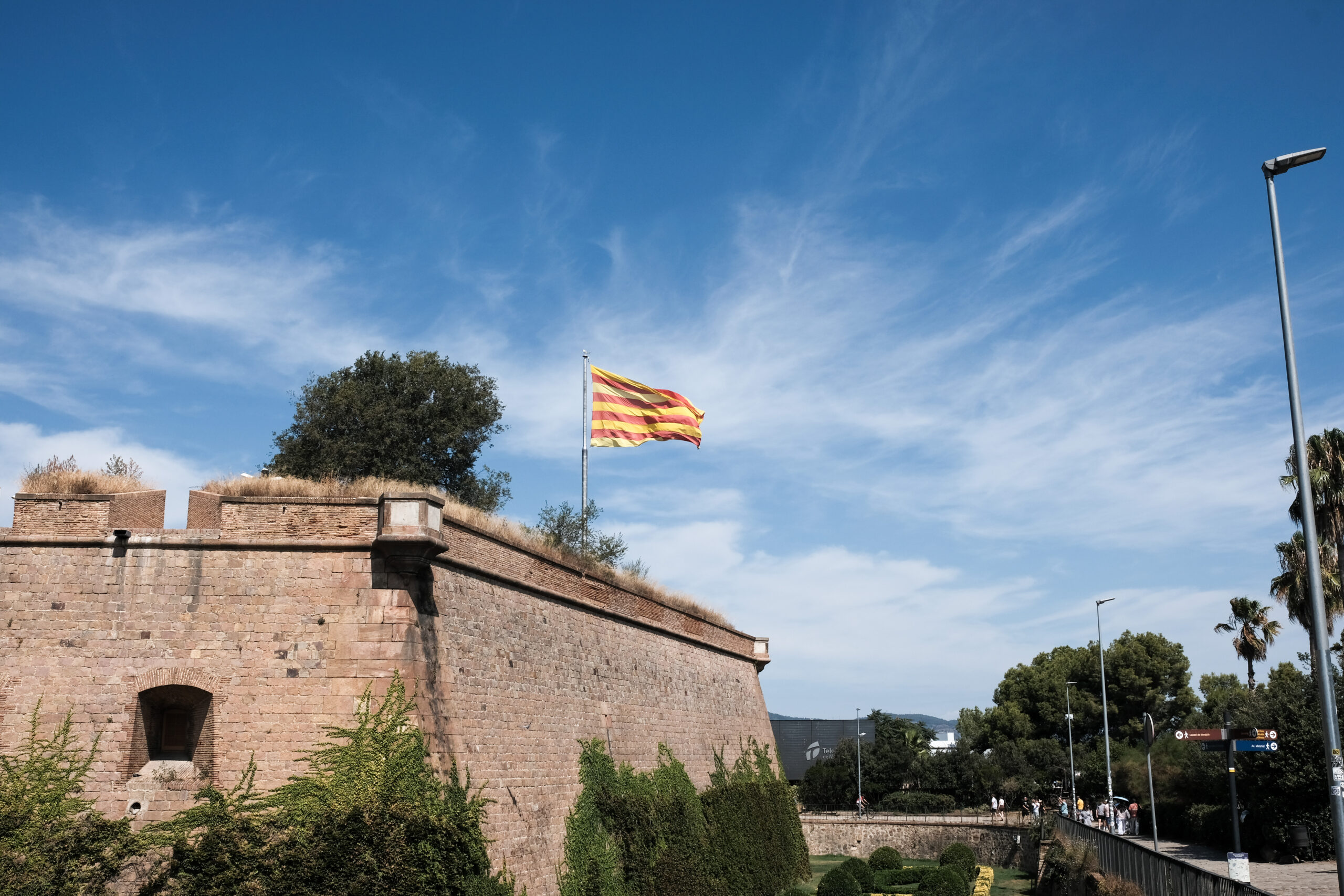
We visited Montjüic – sweeping views over the harbor and the city, walked down through the Olympic village and saw that the diving well pools are now public pools.
The neighborhood festival in Gràcia was a highlight of the visit. There is a contest for best themed street and the residents take it very seriously. Lots of good food (and gelato) just walking around. Gràcia also seemed to be ground zero of the anti-tourist sentiment. It’s a complicated issue – if property investors bought up apartments in your city and rented them to tourists, pricing out the locals… you would protest as well. It’s not necessarily a tourist issue, but a local government issue – I read that by 2029, there are going to be significant caps on Airbnb rentals in Barcelona. We stayed in a hotel.
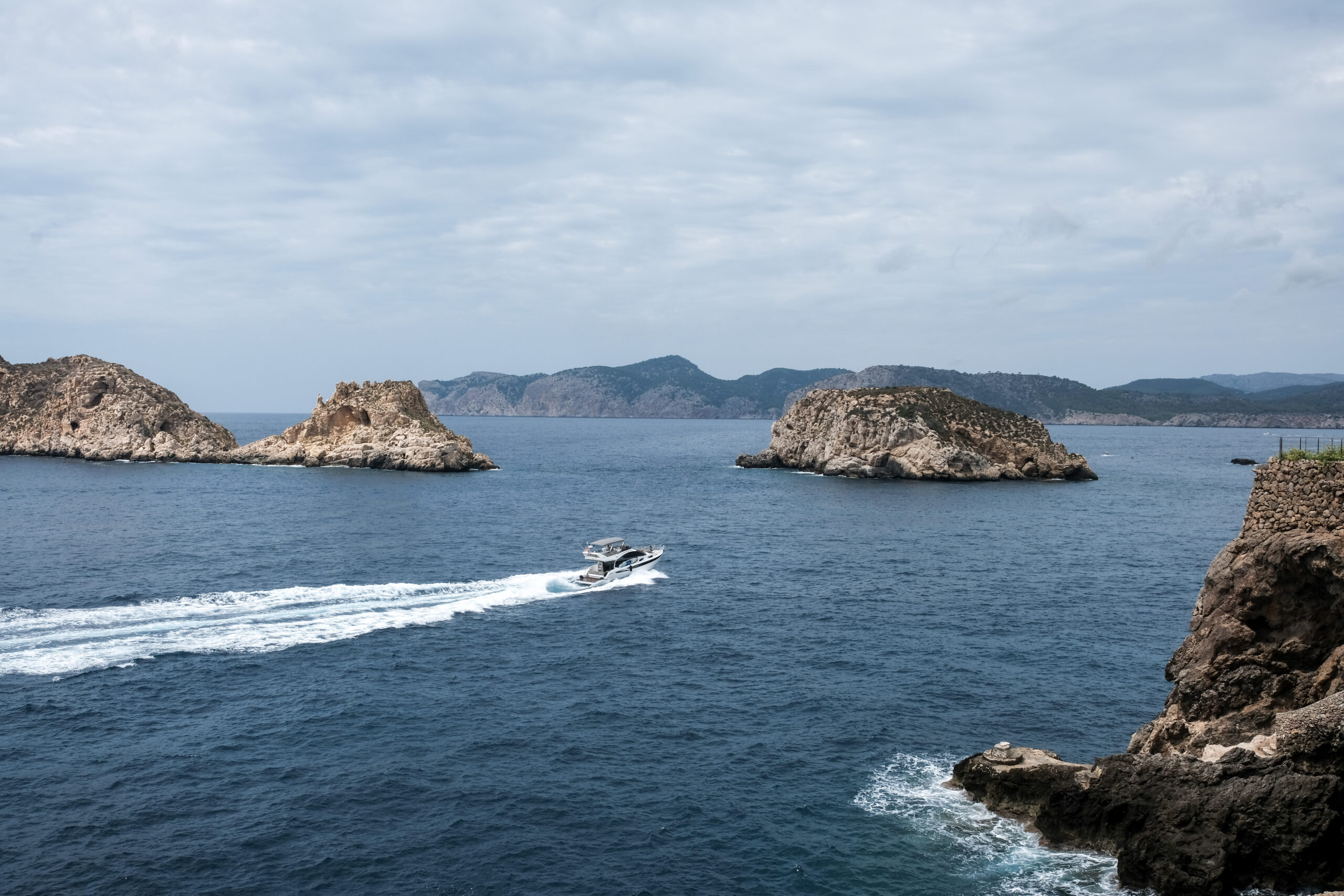
Mallorca is…well… the same and different than I remember it from 30+ years ago. I explained to my girls that it’s about the same as flying from Portland to LA (even shorter in most cases) like much of Europe flies to the Mediterranean and particularly Mallorca. Our beach guide pointed out that the English stay in Magaluf and the Germans stay in Peguera. If you want to party with the English… go to Magaluf.
We snorkeled, cliff jumped and swam around in sea caves. Our Belgian guide took us 4-5 different beaches. It was really the best use of our time as we would have never been able to find the beaches or eaten up time driving all over the island if we had rented a car.
I wanted my girls to experience Mallorca, so… mission accomplished. They’ve definitely got the international travel bug ever since our London trip a few years ago. They’re already asking to go back to Mallorca. I’m ready to find some more off the beaten path locations.
All photos taken with a Fujifilm XH-1 and either the 18-55mm kit lens, or the Viltrox 23mm f1.4 (I love this lens). Classic Chrome film simulation.